Hiking the Wilson Canyon Trail
 |
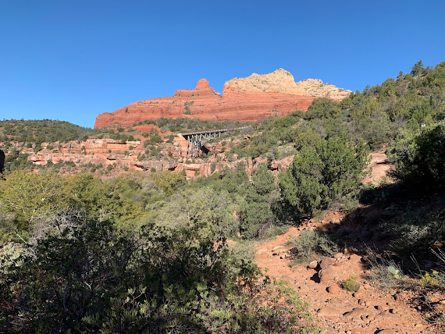
| Midgley Bridge, Highway 89A. This is the Huckaby Trail but the Wilson Canyon Trail also starts near the bridge. |
The desert hiking season has begun. I considered a hike in the Grand Canyon but decided I wasn't quite in shape for it yet. Instead I selected the Wilson Canyon Trail just north of Sedona. It's right on the edge of the desert and features a combination of red rock, desert vegetation, and a few ponderosa pine trees. I've been hiking every winter in the Sedona area since I moved to Arizona in 2015, but for some reason I never did any hiking in Oak Creek Canyon. Always before I hiked in Sedona or to the south or west of town. Wilson Canyon is one of the side tributary canyons of Oak Creek.
 |
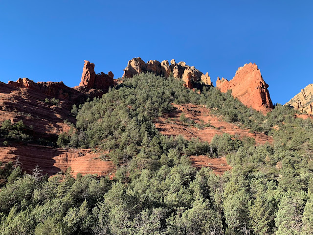
| A view of the canyon, with the mixed vegetation and alpenglow on Wilson Mountain. |
Part of the problem is parking. The trailheads have limited parking. This is somewhat due to the terrain being unfavorable for roads, parking lots, or buildings for that matter. It's a steep sided canyon. As a result, to hike there on a weekend, you really have to get a very early start or you will find yourself unable to park at all. I left the house at about 5:50 am, running behind scheduled because I realized at the last minute that I hadn't fed the cats.
When I arrived, there were two cars in the parking lot already. By the time I left, there were five or six. By the time I finished the canyon trail about an hour later, the lot was full.
 |
| There are frequent glimpses of the cliffs along the trail. You can see the dense undergrowth typical of the canyon here. |
The hike starts off on what is obviously an old road, but eventually turns to single track. Due to a couple of (currently dry) waterfalls, you don't have to descend into the watershed, despite the depth of the canyon where the bridge crosses. You just walk up into the drainage. The trail follows the dry stream bed and crosses several times. There were still some puddles from rain last week, but there was no flowing water.
 |
| The trail crosses the stream here. You can see leftover rain water in the creek bed. |
I didn't see a soul after the first quarter mile or so, including one backpacker hiking out after a night. There are a couple of trail intersections, so it's hard to say which way he'd come from. I always get a little nervous hiking alone near the start or end of a day, that's when the large predators come out. I saw very fresh droppings, but analyzed them to likely be from javelina rather than a predator. I still kept my head on a swivel though. The brush was quite dense in the canyon. I heard some animals moving around but nothing I estimate to be large.
 |
| End of Trail, but keep going. There is a goat path just ahead and to the right that climbs to spectacular views! |
The trail ended with a sign, but I could see a smooth dome of red rock above and to the right and suspected it would be a good place to view the scenery. The stream bed was smooth and beckoned, so I proceeded a few feet beyond it and was rewarded to see a steep "goat path" up onto the dome. The views from the top were breathtaking!
Unfortunately I don't know how to use a camera properly so most of my photos weren't as good as I thought they would be, but the experience is better than the photos anyway. I hung out for several minutes just taking it in.
 |
| These photos don't do it justice. This high, hanging valley at the top of the drainage was absolutely beautiful. |
 |
| A view of Oak Creek Canyon from the vista on the Huckaby Trail. The sun was getting high and I had difficulty taking photos to the east. I used what shade was available. |
I enjoyed views of the bridge and Oak Creek Canyon then followed the trail down steep switchbacks on an old jeep road to the creek, where the trail crosses. The creek is a perfect mountain brook, babbling and whispering over rounded rocks. I hung out for a couple of minutes just taking it in and relaxing. But I wasn't interested in getting my feet wet, so I followed the trail back up to the junction with Allen's Bend Trail and followed it to the access road for Grasshopper Point. The road obviously goes back down the creek again. I was starting to feel like I wanted to go home so I turned around and went back to the car.
 |
| Oak Creek. Flowing water is very rare around Flagstaff, and in Arizona in general. I love visiting a creek or river when I get the chance! |
 |
| Another view of the bridge from the Huckaby Trail. You can see it was a little bit rocky compared to the Wilson Canyon Trail. |
In the parking lot, all the spaces were taken and people were parking in front of no parking signs and contended for the space I was vacating. That's Sedona hiking for you, or at least Sedona parking. I was glad to have gotten an early start and been able to hike for almost an hour without seeing anybody in the beginning of the hike.
It was a beautiful, perfect morning, and I was happy to have gotten in over 4 miles of hiking, all before lunch. I arrived home in late morning with plenty of time to watch Purdue knock off the #2 ranked football team in the country! That was the best Saturday I've had in a while.


Comments
Post a Comment