From April 5, 2014
I've been working the suburban trail systems after work for fitness for a few weeks but finally got a Saturday with no work and amazing weather conditions to get back out on a true adventure. I floundered around trying to decide whether to paddle whitewater, which I would like to get back into now that the weather is warming up, or go for an epic, exploratory mountain bike ride. I decided to try both in a single day.
Since I'm trying to save money for my planned vacation later this year to Colorado, and I'm trying to recover from some house-related expenses, I picked the closest location where this is possible: the Ocoee River area of Cherokee National Forest. Cherokee has an area that is a veritable playground for outdoor sports of all types in Polk County, Tennessee, with the Class III-IV Ocoee River providing predictable, dam-controlled releases of flow on two whitewater sections through the Ocoee Gorge in the Blue Ridge Mountains. I've paddled there many times in the past and have run all of it but I didn't paddle much this winter and needed to get out and practice my roll, and some basic maneuvering and surfing if possible. I put in at the private boater takeout in the headwaters of Ocoee #2 Reservoir, also known as Parksville Lake. Since the lake is still down at winter pool, I had no difficulty paddling upstream to the last class I+ rapids for some surfing and basic maneuvers in current. Then I drifted back down to the parking lot and did a half dozen or so Eskimo rolls to verify that I could still do it. At that point I was getting cold because the water is still fairly frigid even though the air temps are warming up now so I took out and got dressed for mountain biking.
 |
| Back out with the playboat. First time since last year. |
I drove up through the Ocoee Gorge, looking for familiar faces, cars, and boats on the Ocoee, but I've been off the Ocoee for the most part over the last 5 years and everyone is either driving a different car, paddling a different boat, or no longer paddles the Ocoee at all. I didn't recognize a single paddler.
 |
| Signs of spring everywhere. That is the dry channel of the Ocoee River in the background. |
 |
| Signs of the Olympics, leftover from 1996. |
I pulled up to the Ocoee Whitewater Center, home of the whitewater events for the 1996 Summer Olympic Games, officially hosted in Atlanta, Georgia, even though the Ocoee is some 2.5 to 3 hours from Atlanta. It's a pretty neat place, with a section of carefully designed artificial rapids. Actually I hate the artificiality of the rapids of the Olympic section but it's still a pretty neat place. The whitewater center contains an information desk and neat gift shop. The Whitewater Center is also the trailhead for an elaborate system of mountain bike trails known as the Tanasi Trails. Tanasi is the Cherokee word that eventually evolved into the modern "Tennessee." I picked up some caffeine in the gift shop and resisted the urge to spend a bunch of money on stuff I don't need and looked over the maps to refresh my memory of the trail system, which runs mostly through the mountains on the left bank of the river.
 |
| The Ocoee Whitewater Center, a site of the 1996 Summer Olympic Games, hosted from Atlanta, which is not really all that nearby. The flow here is much less than an official "recreational paddling release." The water was being diverted through a pipe to the Middle Ocoee a couple of miles downstream, which is what I was paddling earlier in the day. |
I finally decided on a short warm-up ride of a little over a mile and then a climb up Forest Service Road 45 into the mountains, which features approximately a 1000 ft climb before it intersects with Road 221. There are numerous trailheads along the route, as long as you turn left when 45 comes to a T with 221. I went left and was passed by a number of oncoming mountain bikers, and by a few on the downhill sections. I'm not that easy to pass on very long uphills. I'm a slow rider but a relentless climber when I'm in shape. A 1000 ft climb with few, if any, respites is actually attractive to me. That said, I admit I stopped for a photo op at a couple of points because I knew there were few such. For the most part, the road is tree-lined.
 |
| The first view on Forest Service Road 45 via power line cut. |
I ended up passing by the access points to the Tanasi Trail System out of sheer curiosity to keep following the gravel road. I've been all over the trail system before and it held less interest. That's typical behavior for me. Unless I'm headed for a particular point of interest, like a summit, overlook, or waterfall, I'm pretty bad about not planning a particular route in advance and just wandering. I was enjoying the day and the cool mountain air around 2000 ft above sea level, and enjoying the ride so I saw no need to turn off the gravel forest service road.
 |
| Second view. I believe this was still taken from Road 45. |
Eventually I went down a pretty long descent and began to worry about my ability to get back up it since I'm on a diet and did not eat as much as I might normally, so I turned around in the deep ravine of Rough Creek amid some particular old hemlocks with a thin rhododendron understory and began climbing back up the mountain. When I got back to the top of the first return climb, I took an option to ride a section of the Benton McKaye Trail that allows bicycling. The Benton McKaye is a long distance trail that links the Appalachian Trail with the State of Alabama via the Pinhoti Trail, another long distance trail in the mountains of the South. Most of the BMT is closed to mountain biking but this section is open as part of Tanasi. The section is rolling double track fire road behind gates. It's good mountain biking but old school and features some pretty long but straight and non-technical hills.
 |
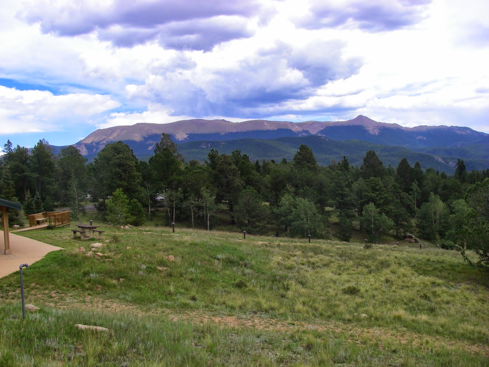
| A view eastward from Forest Service Road 122. The rugged outline of distant mountains in the far distance are in North Carolina and are considerably higher than the mountains in the foreground. This was taken from about 2000 feet above sea level. |
 |
| Hemlocks! Many hemlocks are disappearing from the southeast due to infestation with an exotic insect but there are several ravines in the area that are as yet untouched. I turned around at the top of that hill. |
Finally the BMT joined back in with Road 45 that I had started on and I checked my speed downhill for a mile or more back to the river, this time crossing on a bridge by the dramatic Ocoee Powerhouse #3, where hydroelectricity becomes a thing, to return on the right bank of the river along the road. I couldn't resist the urge to take a photo next to the huge pipe where the river flows downhill into the powerhouse and through the turbines. It's hard to visualize how this works but basically it is more favorable on a river to divert water from a dam upstream through a pipe, downstream and therefore downhill to a distant powerhouse to take as much advantage of gravity as possible for electricity generation. Anyway, cool photo op.
 |
| The entire Ocoee River comes through that pipe - and it was flowing to the tune of at least 1200 cubic feet per second. |
The ride ended up being a little shorter than I intended. That was a result of not having a particular route planned in advance. I painted myself into a corner where I had to choose to go back out and ride more miles than I wanted, do a short out-and-back, which is boring, or just call it a day and go to the restaurant. I'm pretty much hungry all the time right now because I'm on a diet so I chose restaurant. Even though my ride was cut short, I find it difficult to regret exploration, and anyway I'm still getting back in shape from the winter. I definitely have a tendency to over-train early in the season, so it was probably best to layoff the epic distance anyway. I'm still calling it a great ride although not
epic. I got a good workout with over 1800 ft of climbing but did not over-train. Throw in the fact that I got back in a whitewater playboat for the first time in months, beautiful weather, and beautiful scenery in the Southern Appalachians, and it was a great
day as well.
Strava track.

Comments
Post a Comment