Gainesville, Georgia
November 8, 2013
 |
| This vaguely medieval looking structure is the Elachee Nature Center at Chicopee Woods. |
The mountain biking trails at Chicopee Woods have very good word of mouth in the Southeast. I've noticed there are two camps, those that like it as fast and flowy and those that dislike it for lack of technicality. I personally like to ride what is known as "buff singletrack," which is in the fast and flowy category. Singletrack denotes a traditional trail, typically wide enough for only a single bicycle or hiker. Buff means smooth, something that is rare in mountain biking in the eastern half of the United States. I don't mind some technicality from time to time but I particularly appreciate smooth trail. I decided to check out Chicopee last week.
The trail system starts out at a very nicely improved parking area, with some of the loops marked as directional based upon day of week. The trails nearest the main parking area are easy, but interconnect with more difficult trails to form a series of nested loops, occasionally crossing over or joining in with fire roads. It's pretty smooth on the easier trails and the fire roads but some of the intermediate trails have too many tree roots in my opinion. Still, it's a pretty smooth trail system on the whole.
 |
| Stream crossing on the outer loop at Chicopee Woods. This photo demonstrated "fire road," which is a wider type of path found on older trail systems and threading through Forest Service property, or other places where infrequent access is needed. When found on Forest Service land, it is usually intended as access to wild areas to facilitate fire fighting, hence "fire road." Contrast with below . . . |
 |
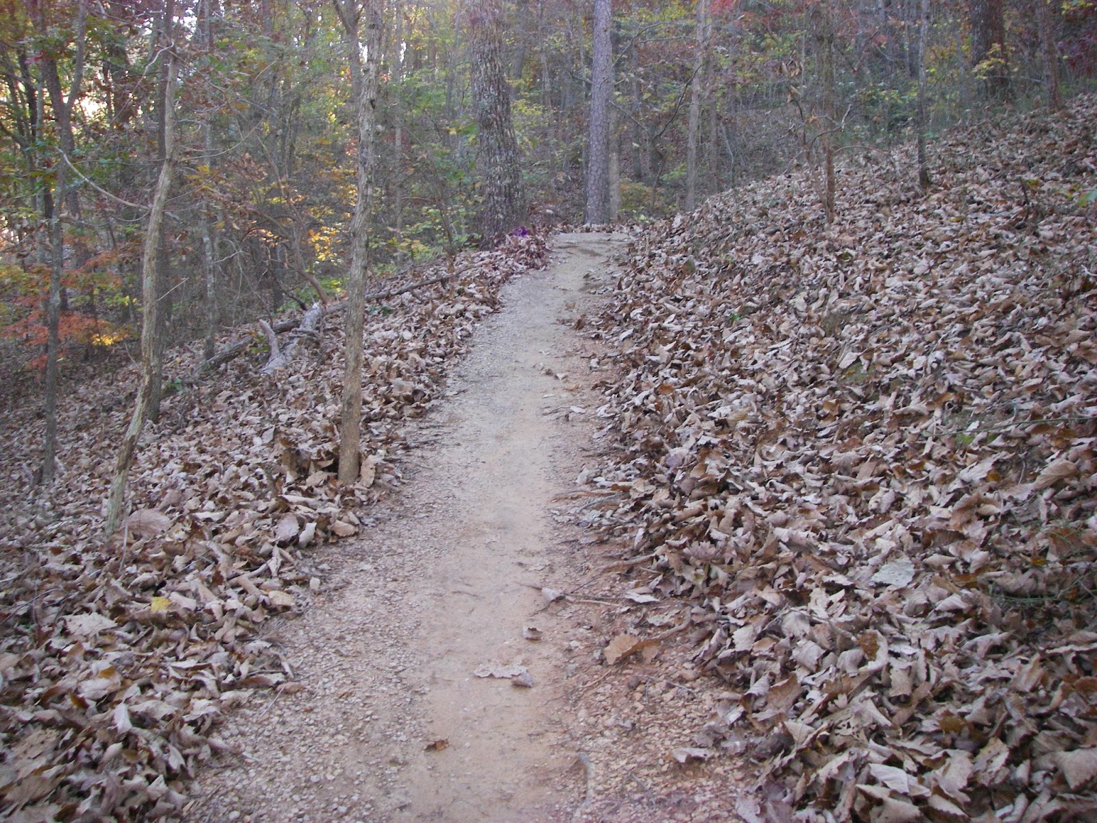
| Baby roller-coasters at Chicopee Woods. This is "singletrack," a traditional hiking trail, in this case groomed for riding mountain bikes. |
Although Chicopee Woods is not in the mountains, it is surprisingly rolling. I racked up 1000 feet of total climbing in 11.9 miles, which is a good workout for me, especially since I have converted my mountain bike to a single speed. This means that I have only a single gear and can't change to easier gears for climbing. Occasionally the trail drops into ravines and there are several nicely constructed bridges for most of these, although I ran into a couple of stream crossings that appear to have been deliberately left in place for "fun." These are among the few points of interest, along with the markers for the location of a small plane crash from the 1990s.
 |
| There are several bridges at Chicopee, of which this is the coolest, although the photo understates the scale a little bit. |
 |
| This cross marks the location of a plane crash, March 3, 1995. Two lives lost. |
 |
| Second stream crossing on the outer loop. |
 |
| There are few points of interest, but there were a couple of small dams that look like the remains of a mill at the major stream crossing. |
 |
| Slightly taller dam. This was after the major stream crossing. I had to HAB for a bit to get over the stream and back up to the rideable trail. |
 |
| I suffered from the leaves for almost my entire ride, but there was someone operating a backpack leaf blower when I was getting ready to finish. This shows a pretty dramatic difference after the job is done. |
It was about 2 hr 15 minute drive for me to get to Chicopee Woods, and although fun, it is probably a place I will only ride once unless I happen to have some other reason to be over that way. Since I had driven over on a Friday when I took a day off work and wanted to avoid the Atlanta rush hour, I decided to take the scenic route home, taking some city streets over to Georgia State Highway 53 which I followed through the foothills of the Blue Ridge Mountains over to Cartersville, Georgia where I jumped back on the interstate. I discovered that Gainesville is sort of a "Little Mexico" for the greater Atlanta area, and drove for miles passing businesses with signs in Spanish, or in both Spanish and English. It was kind of interesting.
It was a pretty good ride at Chicopee Woods, and I would recommend it as a destination if you don't have to drive too far.


It’s an inspiring moment to think of the water cascading down moss-slicked rock all the way down to Clemmer Falls. best hydration backpack
ReplyDelete