Edwards Point via Mountain Bike
11/24/12
I previously scouted out the trailhead for a rough trail
system on Signal Mountain that is widely listed as available for mountain
biking. At the time, I was not impressed. It was terribly muddy double track
with no signage that obviously had been torn up by off-road vehicles and seemed
somewhat like a sketchy area to be riding alone. I neglected it for a couple of
years until finally getting a chance to go with someone who knew the trails.
There are several trailheads and our guide selected one of
the unmarked entry points and we set off. Even though the weather had been dry
for quite some time, we still encountered huge mud holes with regular frequency,
although most of the rough track was smooth enough. The ride out from the
trailhead was mostly downhill and fast. We passed a couple of unmarked trail
intersections but it was pretty clear which paths are the ones that lead to the
lookout point. I asked about markings and my guide pointed out yellow blazes
that mark the main trail. We could hear engines revving off in the woods and
stopped to identify whether or not they were coming our way but eventually
determined the motor vehicles were on a different track and rode on out to the
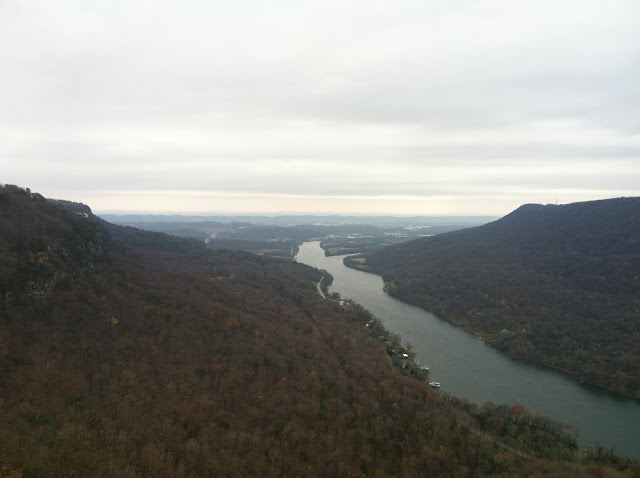
lookout over the Tennessee River Gorge.
Nice.
There were some dirt bike riders out there checking out the
view, along with some various hikers and trail runners with dogs. I got nervous
when some of the dogs were playing right along the edge of the cliff but somehow
they avoided falling over. We took a few photos with cell phone cameras and
decided to head back by a slightly different route. This turned out to have a
rather stout climb over leafy trail slightly narrower than what we had ridden
on the way out. And the climbing continued. I realized that we had dropped more
elevation than was apparent on the way out and soon we were cranking hard, but
it was nothing worse than other local trail systems. Along the way we passed
assorted hikers, families with small children, and kids with department store
bikes. We decided to start exploring a side trail for a while but soon heard
shotgun blasts and I persuaded the others to turn back since it looked like a
more lightly traveled trail and sounded unfavorable due to the gunfire.
When we finally pulled out from the trailhead, we passed
three police cars at one of the other trailheads. My suspicion is they were
attracted by the probably illegal shooting. The view from Edwards Point is nice
but the trail is very low quality and I was cautioned about riding there alone,
which was not encouraging. At least my curiosity about the trail system was
satisfied.
More pics.
 |
| The view downstream. Opposite is Raccoon Mountain. |
 |
| Development on Signal Mountain, because it doesn't have enough already. |
 |
| Stacy goofing on the cliff. I'm surprised she wasn't closer to the edge, normally she would be. |


Comments
Post a Comment