July 14, 2013
I hiked Friday evening, worked on trail maintenance on Saturday on Raccoon Mountain, which was very hard work, then I fixed my mailbox, which had been run over the night before, so I was completely wrung out on Sunday. After wasting half the day sleeping and watching the Tour de France, I knew I had to get motivated to get out of the house and stretch some kinks out of my muscles. I decided to go searching for Dug Gap, another low mountain pass nearby with some historical significance to the U.S Civil War, similar to nearby Snake Creek Gap that I blogged about in a
previous post. There is a poorly maintained park there that is owned by a historical society that appears to be an evening location for young people to drink beer and make out. It was a little underwhelming although it does provide the opportunity to hike around and enjoy a few views of the Ridge and Valley Region. Afterwards I headed over to hike a couple of miles on the Pinhoti Trail, which actually descends into Dalton, Georgia on the Dug Gap Road. It was a good local option to get me out of the house but wasn't good enough to warrant driving a long way unless you are a serious Civil War buff or something.
 |
| The remains of Rebel works along the crest of Rocky Face Mountain, also showing some of the trail. The Confederates ambushed a force of the Union army to the left and down a steep slope. They rolled boulders down the slope to great effect. The trail is well beaten right here but fades out quickly if you keep trying to follow the crest. |
 |
| Marker of the site of the battle along Dug Gap Road. You can get run over trying to take this picture. |
 |
| Storms over the Cohutta Range of the Blue Ridge Mountains. Dalton, Georgia lies below. The Cohuttas form what is known at the Blue Ridge Front in this area. It's essentially the end of the high Appalachians, which vary up to over 6,600 feet above sea level. The parts of the Appalachians that lie to the west of the Blue Ridge are mostly lower mountains, rarely much over 2000 feet above sea level. I was not threatened by the rain because it was moving to the left in this photo. |
 |
| A small butterfly on a rocky promontory above Dug Gap. |
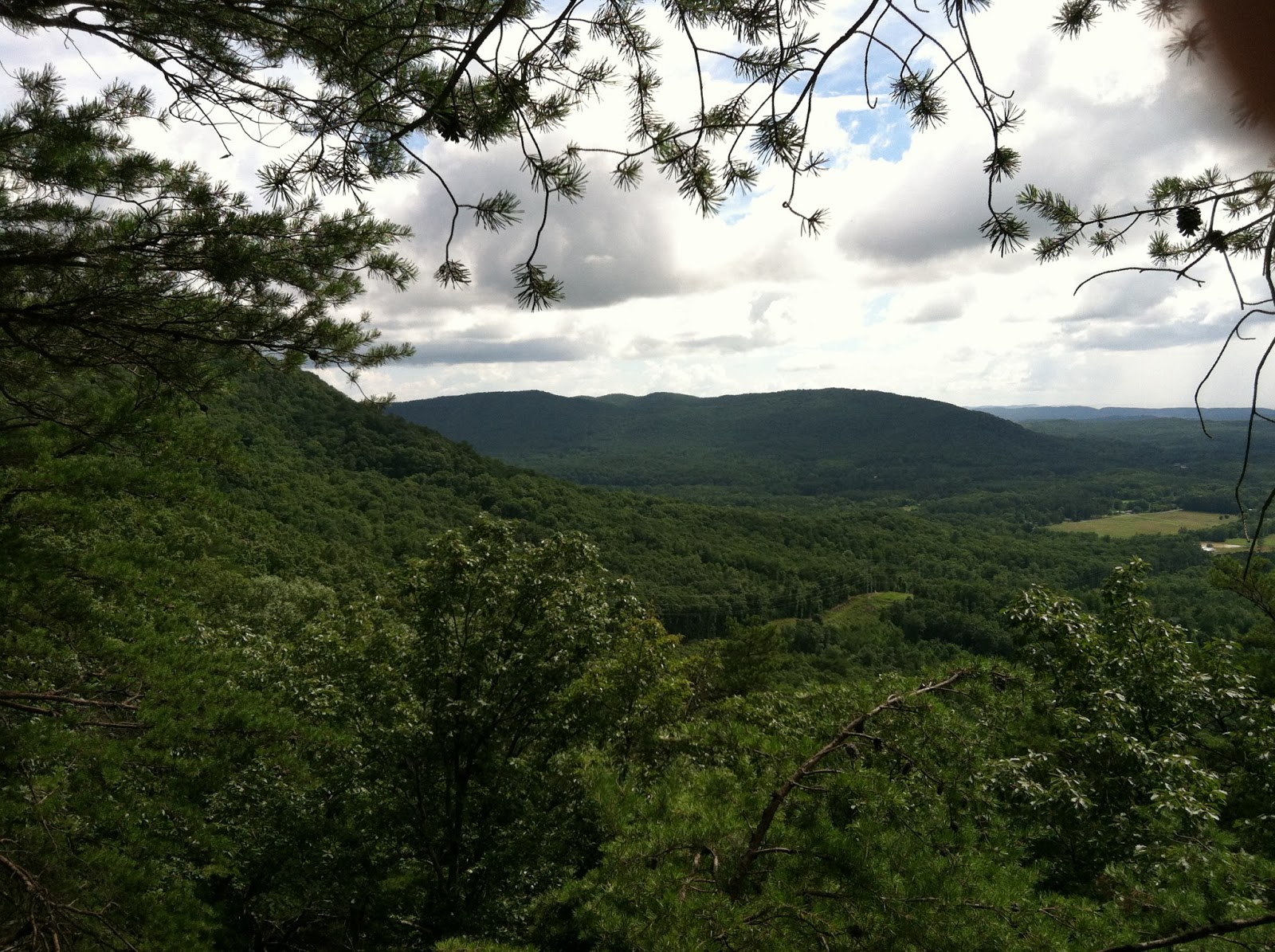
 |
| Nice clouds over Ridge and Valley terrain. |
 |
| My favorite photo of the day. This is taken along the western slopes of Rocky Face Mountain. |
 |
| A view of the Appalachian Ridge and Valley region with Lookout Mountain in the distance. Lookout is a really long mountain, extending for dozens of miles from Tennessee, through Georgia, and into Alabama. I suspect the largest ridge in the middle depth of the photo is Taylor's Ridge, which runs all the way up to Ringgold, and then as White Oak Mountain to near Cleveland, Tennessee. |
 |
| So mad at myself for tilting the phone when I took this photo! Indistinct in the distance are the Blue Ridge Mountains, probably the Cohutta Range to be more precise, obscured by a rain shower. This was taken from a saddle between crests of Rocky Face Mountain when I was following the Pinhoti Trail on a gated access road. |
 |
| Strangely the Pinhoti Trail in this area follows this gated service road that provides access to several different communications towers on top of Rocky Face Mountain, which is above Dalton, Georgia and Interstate 75. Note the Pinhoti Trail marker on the tree to the right. I was starting to feel like I was trespassing until I saw the marker. |
 |
| Finally got to some single track Pinhoti Trail but by that time I was dehydrated and my legs were wobbly so I didn't hike far. That was the third day in a row I had been hiking including a fairly grueling session of trail maintenance, some vigorous yard work, and an after work hike on Friday. |
It was a long downhill back to the car and my legs were trembling by the time I got there. It was a nice afternoon hike and is a good nearby option for me.


Comments
Post a Comment