Humbling Arizona Trail
 |
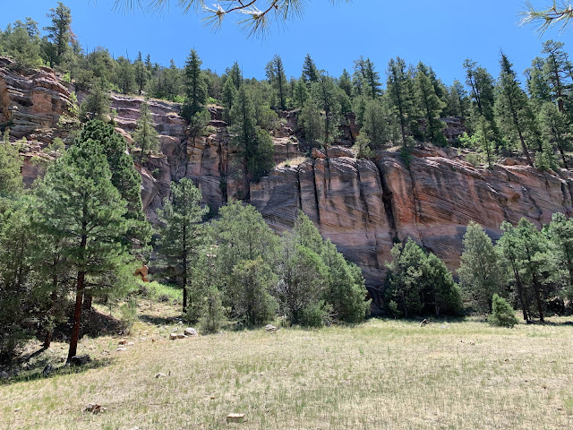
| The rock layers visible here correspond to the upper strata in the Grand Canyon. |
I decided to explore a section of the Arizona Trail that I had not seen before. I started at the Sandys Canyon trailhead, which I have mentioned here before. This intersects with the Arizona Trail after a mile or so, and if you take a right turn you head uphill onto Anderson Mesa.
 |
| I watched birds of prey circling over Walnut Canyon as I looked back towards the San Francisco Peaks. There were several miles of beautiful though dry trail on the Arizona Trail. |
Everything went well for the first few miles. The trail switched back up the mountain through a variety of habitat. The sandstone escarpment along the bottom of the mesa: pink and red; photogenic. After ascending the initial steep sections, the trail levels out a little and crosses a burn scar reminiscent of that on the Hart Trail on the flank of Little Mount Elden. It's beautiful. There are views into the high country. The trail continues climbing into dry pine forest with a few pinyon pines and junipers interspersed. At some point I noticed I was lightheaded but wrote it off to exertion. I drank more water (I was carrying 3 liters).
 |
| Humphreys Peak and the inner core of the San Francisco Peaks from an old burn scar that has started to recover. This reminds me of the Deer Hill Trail. |
As planned, I turned back after the trail crested out atop the mesa and intersected a fire road. The distance from the trailhead had been 3 miles according to my slightly unreliable Garmin watch.
The downhill return started off easy and fast, but I still stopped and rested in the shade, where available.
By the time I reached the floor of the canyon and began to ascend back to my car, I wasn't feeling energetic. I reduced my pace. I was frustrated with the slow pace, but as I hiked up Sandys Canyon, I found it necessary to stop to rest in almost every patch of shade available, and sat down on a boulder at least twice.
 |
| Sandys Canyon, filled with atypical undergrowth and short-needle pines more usual at higher elevations. |
I finally made it back to my car, got the air conditioning going, and returned home without incident. After I got there, I determined that I was dehydrated. This was surprising since I'd had more than enough water with me. I realized that I need stop thinking of hydration in the same terms I would have when I lived back east and at low elevation. I also took my blood pressure and found it high.
The other issue was nutrition. I'd eaten a fairly large breakfast of 3 eggs with butter, Roma tomato, and onions, but even so I don't think I'd eaten enough. The weather was hot (by Flagstaff standards), and the route was hilly. I've hiked much more difficult trails but that was when I was younger and thinner. When I reached the turnaround point, I stopped to consume a gel packet with sugar and electrolytes. This helped for a short time, but I really think I consumed inadequate food for the undertaking.
For what it's worth, Strava rated the Relative Effort as "Massive." Whatever the explanation, I would say the hike is a good route, although I feel a little humiliated that I wasn't able to complete it in a good, healthy state. Perhaps I am simply getting old. I work out regularly but have to admit my diet is not the best. I still hope to have a good second half of the year in terms of fitness.


Comments
Post a Comment