The Verde River - TAPCO to Tuzigoot Bridge
From a trip on Monday, June 15, 2020.
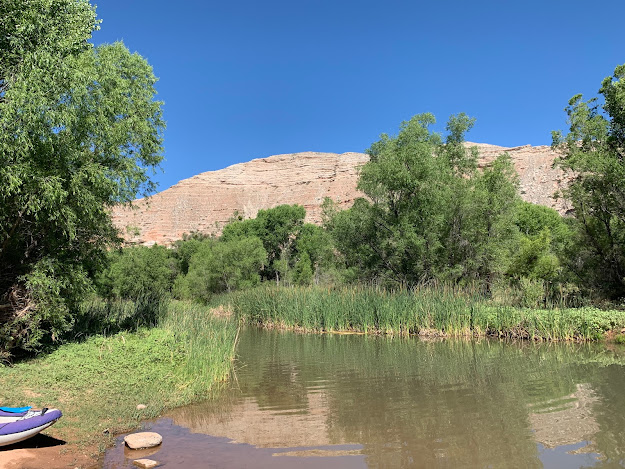
The Verde flows through north-central Arizona through a series of canyons and valleys to the Salt River. It features stretches of relatively calm paddling interspersed with shoals, good scenery with towering colorful mountains, a pueblo that is visible from the river just down from the launch, vegetation, and wildlife. More remote sections feature some more difficult whitewater. The easily accessible section in Clarkdale from the TAPCO River Access Point (RAP) to the Tuzigoot RAP features rapids up to about class I+ (maybe class II at very low water). It was swifter than I expected and I was told that the June water levels are about as low as it ever gets.
The water quality was quite good, though there are cattle roaming around in the open range in which the TAPCO launch site is located (TAPCO was the name of The Arizona Power Company, later APS, and an old power plant was located just upstream of the launch). After living in Arizona for over 5 years, it is always refreshing to see a flowing river with abundant life along the banks. It's become a somewhat rare sight for me and I hunt places within range of Flagstaff where flowing water can be seen.
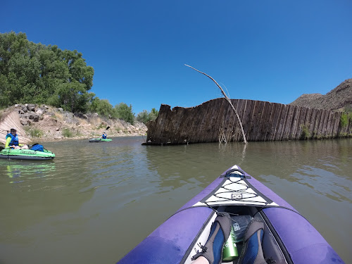
This section of the Verde features mostly very long pools with rock shoal drops consisting of wave trains. The most significant rapids are Willow and Boulder, the later of which has more of the quality of a rock garden drop. Willow flows in a very narrow channel swiftly along the left bank for a few dozen yards with a modest wave train. It was the most fun. Boulder was quite low and everyone got stuck except me, though I had the benefit of seeing people get stuck before me to choose my line. I eddied out, picked a line along the left and slid over shallow rock into the pool below.
Aside from the cattle, we spotted various birds and fish. There were catchable size fish jumping periodically. The air was filled with birdsong and insects. I saw a couple of dragonflies, a rare sight in Arizona. The forest along the banks was dominated by cottonwood and what I presume to be willows, but we also saw some catclaw, a notorious bush that grows in the surrounding high desert. There were even some ferns in the well-watered river bottom.
We had one swimmer on the day, the victim of one of the sharper eddy lines where an old "diversion dam" failed recently. This was a structure meant to provide a pool of water to feed into irrigation canals or aqueducts. The decision was made to not replace it.
It was not a bad day for swimming, with a high of around 96 F, though we got an early start and avoided the heat of the day. The water temps were cooler though, and this moderated the heat. Clarkdale is around 3500 ft above sea level, which in Arizona means that it is a very hot time of year and moving any significant distance from the banks brought you into the dry blast furnace of Arizona June. All the better to be on the water.


Comments
Post a Comment