One of my concerns about moving to Arizona was the lack of surface water. Whitewater paddling has been one of my hobbies since 2001 and at one point practically defined my life (which I realize is a little pathetic). The whitewater scene is really a subculture and I acquired most of my friends through the sport and spent most of my free time and money on it for a number of years. Recently I have spent less time paddling than I did in the mid-2000s due to increasing back pain, but that doesn't mean I am ready to give it up completely. I still find enjoyment in an hour or two on whitewater.
While there is a small amount of regularly flowing whitewater in notoriously dry Arizona, it's a challenge to find opportunities to paddle. One of the best options is to head to Colorado in the spring. It's not that far away and the drive is very scenic. The paddling is seasonal, depending on snowmelt, so I looked for an opportunity . . . as soon as I was not on call (one of the hazards of working for a hospital network). I had been putting off changing my driver's license to Arizona so I took a Friday off and used the morning to get that done and then packed up and headed out for Durango, Colorado. It's about a 5 hour drive from Flagstaff.
Actual flowing water in the Animas River. Note the plants underwater on the stream bank. It's not flooding but it is high. Also note that the mountainside makes it look like desert. That's a false impression.
The drive led me through some territory I had never seen before. The most direct route involves two lane highway through the Navajo Reservation and a lot of range and desert. There is a veritable ocean of red sandstone slick rock and as I descended into valleys I watched the exterior thermometer reading in my car's dashboard climb as high as 104 degrees Fahrenheit. It's some of the most spectacular scenery I've ever beheld. I did not really take the time to get any photos but it's well worth the drive if you are ever in the region and would fit nicely into a trip to the "four corners" where Arizona, Utah, Colorado, and New Mexico meet at right angles.
The scenery changes over to greenery after you've been in Colorado for a half hour or so and soon you see a land where classic the mesas, buttes, and rock towers of the Desert Southwest meet the Rocky Mountains. In mid-June, the high country is capped with snow and the sun reflects brilliantly off the high peaks of the San Juan Mountains. The western author Louis L'amour referred to the San Juans as a place with "land turned on end." This reflects the verticality of the terrain, with huge fault blocks showing exposed strata running at crazy angles from the horizontal. The San Juan Mountains combine classic Rocky Mountain scenery with the shelf layering of rock strata and in June are still capped with snow. It's a beautiful region.
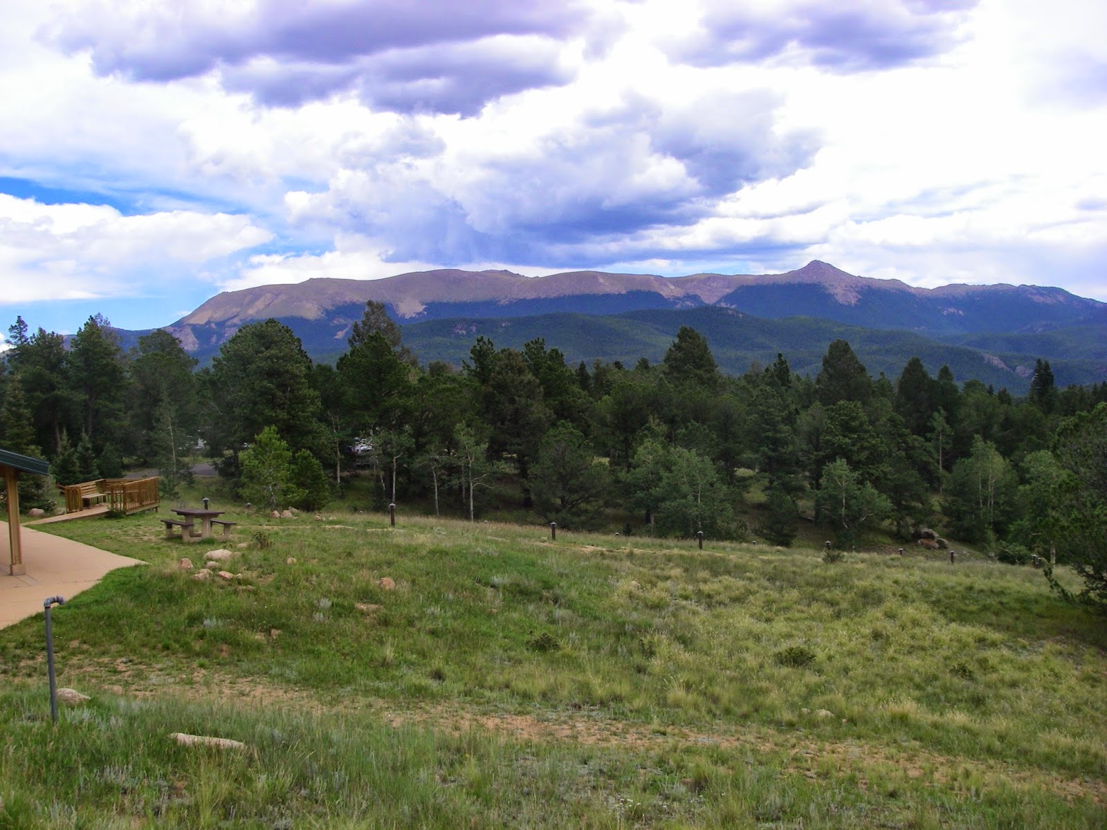
The San Juan Mountains, a sub-range of the Rocky Mountains.
Durango is a neat small town, although a little overtaken with tourists, at least in the summer. I was originally planning to camp but gave up on the idea because my gear was scattered in my apartment and storage facility rental due to my cross-country move. Instead I just reserved a hotel downtown so I could wander around and eat at interesting restaurants. The rushing Animas River flows through the middle of town so I was able to see that the hot weather of the weekend had it bank-full with water - just short of flooding.
Downtown Durango, a traditional American downtown with many shops, restaurants, and bars. It's a great place to walk in the evening.
Not as good as the seeing the real thing. These wildlife statues seem to be very popular in western towns.
I stopped into a steakhouse with a bar and ate one of the most expensive meals I've ever eaten. It was good, but not necessarily worth the stiff price. While in there I saw a retired professional bicyclist. I could not place his name but he was wearing a hat with a team logo. When he saw me noticing him, he turned the hat around backwards to hide the logo. I do not celebrity worship (it's a long story involving disappointment) so I would not have interrupted his dinner for a photo or autograph but I don't blame him for the caution. I sat at the bar to avoid a long wait and there was a middle aged couple there. The husband was a movie producer and was throwing money around and running his mouth about who he knew and what movies he had made. Honestly I had never heard of any of his movies. It sounded like a combination of B-rate and minor documentary films. Durango is a Colorado mountain town stereotype, packed with retired celebrities and rich Californians throwing money around. I found it humorous. I made sure not to drink too much of the craft beer on tap so I would feel good for paddling the Animas the next day.
The whitewater park. This was the easy wave at > 4000 cubic feet per second. It's about 6 feet high. I've run more difficult whitewater but not alone.
I got up and went to the Durango Whitewater Park early and there were no paddlers there yet, so I started scouting. I was pretty disappointed when I realized that the water level was so high that the rafting companies were not running trips through that section. I have run whitewater about as difficult as what I saw in the whitewater park, but not any more difficult. A comparison to my former local runs would have been the Olympic section of the Ocoee River, except for one terminal-looking hole that I would say was a little worse and probably dangerous to run even for paddlers more advanced than me. Since I was alone and no other paddlers were to be found, I decided to do a solo run above the Whitewater Park in a section that looked more reasonable. I hiked the river walk trail upstream and found a put-in about a mile from my car. The river looked like continuous class II to II+ rapids and I thought it would be safe enough to paddle solo, although the water was extremely fast and recovering from a swim would have been extremely long and difficult. I forbid myself to swim.
A view upstream on the section I soloed. It was basically continuous class II-II+. The water was extremely fast and turbulent due to the high water levels. The barren slopes in the background do not indicate true desert but rather a result of the way the material out of which the mountain is made erodes.
By the time I put on, I had seen some other paddlers with Idaho plates driving in and out of the parking lot. They looked like they were scouting launch sites and takeouts, but I didn't get a chance to talk to them. Anyway I'm a little shy about things like that - not outgoing enough. I changed into my gear, prepped my boat, and started carrying upstream. Fortunately I have been working out like crazy since I moved to Flagstaff so I wasn't too stressed by carrying 40+ pounds of gear a mile upstream. It's a good feeling when you do some demanding task and realize that the exercise is paying off. I finally arrived at my chosen launch site and took a breather, then tried to calm down as I looked at the muddy water racing by. I reminded myself one more time not to swim. Verbal affirmation usually works for me so I said aloud in the imperative, "No swimming!" Then I peeled out in the current.
I quickly approached a road bridge and chose to stay left based upon my scouting of the section. I felt a little tippy when I went through some of the funny water along the bridge piers since I had not been in a boat for about 6 months but I did not flip over. There were a few eddies to catch below the bridge so I worked the run as much as possible. Unfortunately due to the high temperatures the river was really pumping with snowmelt so there were much fewer eddies than I would have liked and I did not find any good play. As is always the case, the whitewater looked easier from the road and soon I found myself in some chaotic wave trains that were bigger than I expected. I kept reminding myself to stay forward when I hit shifting diagonal waves and found myself unexpectedly turned sideways a couple of times. Rivers at high water levels are turbulent and unpredictable like that.
Although I was nervous and a little shaky from months off the water, I don't think I hit any waves taller than 3 feet, well within my experience and ability, even when out of practice. It was just rolling funny water, moving at about 10 miles per hour or more. All too soon I approached my planned takeout above the whitewater park. It was a very short float, but I was not about to run through the 6 to 7 foot wave-holes of that section, especially not while paddling alone. The only place that looked really bad was a single river wide hole that had a narrow line that was intermittently closing down into a foam pile, then opening back up to a clear tongue, but I stuck to the plan and took out.
I kind of wish I had simply portaged the three big rapids and continued paddling because when I got down below the terminal hole there were a couple of groups of kayakers playing in the easy water at the bottom of the run. By the time I noticed, I had already changed out of my gear and was ready for lunch. I hope to go back to Durango again when the river is running, either this summer or next spring, and get in a longer run of the river. That said, it was great to be back on whitewater, even for a short run, and now I'm trying to figure out a way to get in another float trip before too much longer.
The easy surfing wave at the bottom of the whitewater course. There is some construction in the foreground. I'm not sure I'll get back this year but it will be a very nice place to paddle when it is finished.
I had made up my mind that since my whitewater run was short, I would drive over the famous "Million Dollar Highway" through a series of passes in the high San Juan Mountains, a sub-range of the Rocky Mountains. For some reason, Durango tends to look like desert in photographs, but that does not reflect the reality. In fact, it is in the Rocky Mountains and the vegetation, the river, and the terrain all seem like the Rockies, except for a few mountains. The photos just reflect some particularly dry mountain slope micro-climates that are not uncommon to the region but are localized. Most of the area is verdant with classic alpine scenery.
The view from Molas Pass on the Million Dollar Highway. There are numerous 13,000 ft peaks here.
I was not sure exactly what to expect from the highway but what followed was the most scenic drive I have ever driven. It was even more scenic than Trail Ridge Road in Rocky Mountain National Park, although it did not quite get up into the alpine tundra the way Trail Ridge Road does. I took a lot of photos but unfortunately my Pentax camera apparently had a smudge on the upper right corner of the lens and most of my pics are partially blurry. I also had my GoPro with me so I got a handful of good photos and about an hour of dashboard camera video, which looks pretty good upon first review although I could not keep the windshield clean of bug splatter, it being a very warm summer's day and the air filled with insects. I hope to edit the video into a condensed form soon.
Views like this all along the highway . . .
Blurry, dammit!
A very red mountain. This area is somewhat denuded of vegetation due to past mining activity, although the red color is a natural effect of the composition of the rock.
After I got back to Durango, I hit up another decent restaurant bar that evening for a seared Ahi tuna salad, which was delicious, along with a very good vodka tonic with lime and a draft brown ale. It was great food and drink and cost less than half what I had spent the night before at the steakhouse. The salad was one of the best I have ever eaten. I strolled back to the hotel room at a reasonable hour to ensure I got enough sleep to mountain bike on Sunday.
On Sunday I took some advice I picked up in a bicycle shop in Durango's picturesque downtown and headed to the Hermosa Creek trail system. I had really been hoping to ride part of the Colorado Trail onto alpine meadows, but I thought it was apparent that my fitness was not up to that level this early in the year so the trail choice was a compromise. More on that later.
The canyon of Hermosa Creek with snow capped peaks in the distance. You can clearly see the blurring of the camera lens in this photo, much to my frustration.
The Hermosa Creek Trail actually reminded me a bit of some southeastern mountain bike trails. The forest was predominantly pine and fir but the undergrowth was relatively thick due to the moist spring and there were two stream crossings to contend with. Some of the ravines were lovely with thick green undergrowth, the sound of flowing water, and the feel of moisture in the air. As the trail started more or less at the mouth of the canyon, the "out" of the "out and back" was mostly uphill. Soon I was regretting my existence and longing for a quick end. Although I knew I was not in tip-top shape, my fitness was actually decent, but the trail ranges from around 8,000 - 9,000 feet so it's not to be trifled with, even by someone who lives around 7,000 feet as I do. Fortunately I've gone mountain biking so many times when I was out of shape that I knew how to contend with it pretty well and keep going. The trick is to back off before the burn really sets deeply into your leg muscles. If you get short of breath you can usually rest and recover, but if you burn your leg muscles badly with lactic acid then you are done and will have no power for the rest of the day.
The Quaking Aspen were quaking in the afternoon breeze.
After a while I started to realize that I was not going to be able to ride the entire trail 9 miles out and back and decided to turn back around 5 miles. This decision was confirmed when I encountered a very long downhill that I did not want to have to ride back up on the return to my car. When you are done, you usually know you are done. If you don't, then you have not pushed yourself hard enough frequently enough. Know thyself!
The San Juan Mountains from the Hermosa Creek Trail, or a side trail, I can't remember.
Instead of trying to ride all of the Hermosa Creek Trail, I took a side trail up the Dutch Creek drainage, based upon the advice of a rider I met at the trail intersection. I did not get very far due to cattle. One of the strange things about the trail system is that it goes through open range. This does not imply that there is no forest, as the ride was almost entirely in forest, but rather implies that cattle range freely in the area, confined only by a mishmash of wire fence, steep terrain, and cattle guards1. I saw several cattle on the ride, one of which showed the characteristic bobbing of the head as if it was about to attack. I got through that incident without difficulty but on the Dutch Creek Trail I encountered a small herd of some 20 head that were sprawled out, resting right on the trail. Since I had gone well over 4 miles out, I decided that was a good enough point to turn back.
This has never happened before - cattle on the trail, and I don't mean the Chisholm Trail.
The ride back was mostly downhill and so went by much faster. Some of the uphill technical sections that I had not been able to ride due to lack of leg power became fun downhill rolling. If you keep up enough speed, a mountain bike with 29 inch wheels will roll over much bigger things than you think. It still averaged out to a very slow ride but I don't mind, since I was really as much interested in the scenery as the riding, and stopped to take pictures and some video. I did not ride far enough on the Hermosa Creek Trail to get to the wide open meadows with views of the snow-capped San Juan Mountains, but it was still a very scenic ride.
After making a couple of Father's Day phone calls back east, I got my act together and finally started heading back to Flagstaff. I really, really enjoyed my weekend in Durango and even though the drive is a little bit lengthy in practical terms, I certainly plan to go back. In fact, I'm pretty sure I will go back later this year to try to ride a local section of the Colorado Trail once I get in slightly better condition. Then, assuming nothing has changed with my living circumstances, I will probably go back next April or June to paddle again. It's a beautiful area and makes for a nice weekend getaway.
Footnotes: 1 A cattle guard is a pit or trench, usually made of concrete, with a metal grating that is installed on a road instead of a fence with a gate. A car can travel over the grating but a cow cannot walk across it. In that sense, it is a replacement for a gate.


Comments
Post a Comment