[Author’s Note: this is the narrative of a trip I took in
2010. From details on the scraps of paper the draft was hand written upon I can
tell it was written almost immediately after I returned, although I did not
date the document. I did not have a blog at that time but fortunately I
remember I wanted to write down my account while the memories were still fresh. I had completely forgotten that I'd written it. I’m so glad I found it!]
After decades of saying I was going to do it, I finally
planned and carried out a vacation to Colorado.
Having taken up the hobbies of whitewater kayaking and mountain biking,
I considered my options. In the end the time of year determined my choice.
Planning the vacation for September, a dry time of year in Colorado, I decided
to skip paddling in favor of mountain biking. As it turned out, there was some
dam-release whitewater running in Colorado but I think I can say I didn’t miss
it. There was enough else to do anyway.
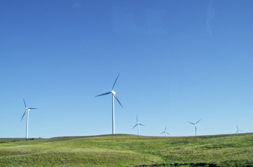 |
| Even the drive across Kansas blew my mind (no pun intended). I had never been up close to windmills like these before and was staggered by their sheer size. |
 |
| True big sky country in far western Kansas. |
 |
| Pikes peak on the horizon. I can't even begin to explain how excited I felt to see the Rockies ahead. This side highway that led from the interstate to Colorado Springs also gave me a view of true cattle country that I had never seen before. |
The drive from Ringgold, Georgia is 20 to 21 hours to
Colorado Springs, where I had reserved a camp site in Cheyenne Mountain State
Park. I stopped on the way after 14.5 hours in Salina, Kansas to break up the
trip. In daylight, Kansas is a lovely state, much better than it's reputation for flatness. The central part of the state is particularly beautiful with rolling grass covered hills. Arriving the second day at Cheyenne Mountain, I quickly settled into my
beautiful campsite in a grove of stubby Gamble Oaks. The park is relatively
new, having opened in 2006 and as a consequence everything is new and
contemporary. The facilities are excellent and the employees and volunteers
were all friendly. I took in my first taste of Rocky Mountain scenery since I
was 5 years old and reveled in it before heading out to get a look at Colorado
Springs, get a bite to eat, and find some wi-fi.
 |
| Unloading at my campsite on the lower slopes of Cheyenne Mountain. It's a beautiful park. |
The next day I awoke early, still living on Eastern Time,
and headed to Pikes Peak with some direction from a friendly volunteer in the
park visitors center. Unfortunately it was busy at the mountain and I had to
wait in line for about a half hour to get to the gate. It cost $12 for one car
with 1 person. The drive to the top was a little frustrating, with some people
not understanding the distance and wanting to drive 5 to 10 mph and others with
no care whatsoever wanting to break the speed limit all the way up. I image
it’s a lot more enjoyable on a normal weekday. The volunteer at the park had
persuaded me that the peak often clouds up in the afternoon so I chose to drive
directly to the top while it was still a clear morning and take my time at all
the hiking spots and overlooks on the way down. The road eventually climbs up
to the tree line and above and it activated my agoraphobia (fear of large open
spaces) with no guard rails and steep slopes where a car could tumble
end-over-end for a mile or two if it were to go over.
 |
| Don't go off the road here. That would be bad. |
The scenery becomes spectacular and finally you arrive at
the top, more than 14,000 feet above sea level and the air is cold as well. I
was wearing shorts but donned my hiking boots with wool socks and a fleece
anorak thing to hike around the top. Except for their being way too many
people, I have to say it was awesome and I recommend it to everyone.
 |
| A view of Pikes Peak over a small reservoir on the road that leads to the top. |
 |
| I've heard that elevation has been revised. This is the highest ground I have stood upon, not counting airliners. |
 |
| Yeah. This is me, age 37. Can I go back to then? There are some things that need fixed. |
That night I camped in the howling wind. I heard a few
animals around but otherwise it was a good night. I later figured out that the
animals were small rabbits common in the scrub and grassland of the Front Range.
They were almost tame and it was possible to approach very close although for
some reason I never took a photo. They were smaller than the cottontails we
have in the east, and somewhat stocky looking. I researched online and
determined they were likely a prairie sub-species of cottontail.
 |
| Camping here. If I could camp here, on this day back in 2010, I'd be perfectly happy if it was Groundhog Day and I could relive it over and over again for the rest of my life. The Colorado Front Range is the most perfect place in the world in early September. |
The next day, Labor Day, I decided to try out mountain
biking. I had put it off for a couple of days to attempt to allow my
cardiovascular system to adjust to the altitude. I chose to start at a
trailhead near my campsite and ride some easy trails down towards the visitor’s
center, near the bottom of the mountain slope. The trail designers there favored
these tight rock formations that you can barely fit through on a bike without
snagging a pedal. At first I was excited that I was having little trouble
breathing but eventually I had to start climbing again to get back up to my
campsite and that’s when it got ugly. I had to stop about 3 times to rest where
normally I would have expected to complete the entire climb. In the end, I had
ridden about 5 miles, not much by my standards but considering the elevation, I
thought it was pretty good. [Commentary added in 2014: I also have to mention
the quality of the trail as it was smoother than anything I had ridden in the
Southeast, or have ridden since. Trail is just smoother out there].
 |
| That is what I call smooth singletrack mountain bike trail. For anyone thinking the path had a surface laid down, I assure you, that is just what the soil looks like there. The pink granite of the region naturally breaks down into fine pea gravel, and there are virtually no roots. |
 |
| A view from one of the mountain bike trails at Cheyenne Mountain State Park. |
After mountain biking and lunch, I decided to head over to
check out Garden of the Gods, a series of red sandstone rock formations on the
edge of town. It being a holiday, there were way too many people present, but
the problem wasn’t the numbers, it was the fact that too many were in a hurry.
I got some spectacular photos and after I got off the sidewalks and onto some
actual trails I enjoyed the experience. [Additional commentary from 2014: my
memories of Garden of the Gods now are wonderful so although the crowds were annoying
at the time, I had completely forgotten until I reread the draft, which feels
like a victory of some type.]
 |
| The Garden of the Gods. Pikes Peak is the high mountain in the distance. |
 |
| Garden of the Gods. Cheyenne Mountain is in the distance beyond the last red rock formation to the right. |
 |
| Balanced Rock at Garden of the Gods. |
 |
| This cute girl asked me to take a picture of her with her friend and then took mine. And that was about 20 pounds ago. |
The following day (the fourth day of the trip) I actually
followed up on the Manitou Cliff Dwellings, which had been too busy on the day
I went to Pikes Peak. This was a cool bit of history, with ruins that dated
back to before the arrival of Europeans in North America. It was a relatively
short experience (about 90 minutes including the attached museum) so I went up
to eat lunch in Woodland Park and then on to Florissant Fossil Beds National
Monument. I had arrived just in time for a lecture in front of two giant fossil
redwood stumps from over 30 million years ago – very interesting natural
history. Then I went on a 1 mile loop hike to see the rest of the petrified
forest under an angry afternoon sky.
 |
| The cliff dwellings at Manitou Springs. I had trouble getting a wide view of the site but this gives you a pretty good idea. |
 |
| A petrified redwood stump at Florissant Fossil Beds National Monument. |
Then with about 3 hours of daylight left, I decided to take
the scenic route back to the campground so I could have a good look at
authentic Rocky Mountain high country. The drive led me through high range land
and remote parts of Pike National Forest and into an area of “high chapparel”
that is one of the most desolate, lonely stretches of highway that I’ve ever
driven. I was amazed by actual tumble weeds rolling across the highway. My GPS
told me I was well above 8,000 feet for much of this drive. Finally in the waning
hours of daylight I descended to the Royal Gorge of the Arkansas River. The vegetation
around there really drops off and it becomes a near desert. I didn’t get to the
gorge in time to cross the bridge but I did get to the overlook to take
pictures. It’s an amazing place, with the gorge a vertical 2000 feet deep. Then
I headed back to the campsite in the dark through Canon City, eating at a Denny’s
(I miss Denny’s, there are none in the Chattanooga area). That was a full day.
The following day I decided to try mountain biking again,
this time somewhere with a more authentic western feel. I had originally hoped
to ride in the high country but having experienced the effects of hypoxia on
Monday, I decided it was best to ride around 6000-7000 feet. The place that
looked good was Red Rocks Open Space. The concept of an open space was new to
me but they appear to be all over the place in Colorado. Basically it is a
park, in this case a city park, but a park that preserves some of the feel of
the original open range where foot traffic, bicycles, and horses are expected
to share the use. It’s an interesting concept. Red Rocks is located around some
mini-canyons of red sandstone similar to that at Garden of the Gods, and in
fact it is relatively close to Garden of the Gods.
 |
| Putting the "open" in Open Space. This is an example of the grasslands of Red Rocks Open Space. That is Garden of the Gods in the distance, the mountains of the Rampart Range in the background. |
The ride did not start off well and I was immediately
breathing hard. Then I lost the trail and gashed open my shin on a pedal and
had to tend to it with my medical kit. I was ready to give up when I finally
found the correct trail and having spent the first 1.5 miles climbing now had a
nice long gradual downhill. After that I had caught my breath and felt warmed
up and I was able to explore much of the remaining trail. Although it was not a
wilderness experience, it was a great ride. I took my time, photographing all
the unique rock formations and getting pictures of the surrounding mountains
and the Garden of the Gods. I really felt good although I still think I rode
only 6 or 7 miles at the most.
 |
| Putting the "red rocks" in Red Rocks Open Space. The park is in Colorado Springs but trails lead from here into Pike National Forest and thence into the high country. There is a virtually unlimited amount of riding and hiking available from this city park. We have nothing on the scale in the Southeast, at least not from a sizable town. |
 |
| Another view of the sunlit Garden of the Gods from near the high point of Red Rocks. |
 |
| Non-red rocks at Red Rocks Open Space. There are dinosaur tracks up there somewhere but it's now off limits to the public. |
 |
| More red sandstone. |
 |
| An abandoned rock quarry. This was hike-a-bike for me. |
 |
| There are a some pillars similar to Garden of the Gods here but not on as large of a scale. |
Later that evening and the next day my legs were very sore
and I figured something out. The elevation doesn’t only affect your lungs. It
also affects your muscles. The reason you need to breathe hard is because your
muscles need more oxygen when they are working hard. I had wondered why my legs
seemed to be struggling in addition to my lungs but it all makes sense now.
The next day (Thursday), I left for Rocky Mountain National
Park, diverting a little out of my way to have a look at the city of Fort
Collins, because everyone always says it is so great. Although it is a nice
city, it seems a little overly yuppie-infested. It also has the look of a cold,
snowy place. I have trouble describing what I mean by that but I’ve been to a
lot of places and when I see a place that reminds me of Canada I think “Woah!”
Fort Collins is farther north than Colorado Springs and I think it must be
colder.
Finally I drove up into the park via Big Thompson Canyon and
the town of Estes Park. What is there to say about the park? It’s an amazing
place. There are numerous mountains of over 10,000 feet elevation and many square
miles of alpine tundra. There are beautiful green forests of Douglas fir and
glacial lakes. There are even a handful of glaciers that remain, although they
are now small. Elk and other wildlife abound.
 |
| A view of Long's Peak (I think) from just a few yards uphill of my campsite in Rocky Mountain National Park. |
 |
| The south end of a north bound elk. I'd never seen an elk in the wild before I went on this trip. |
 |
| Moraine Park in RMNP. |
The first evening I went for a short ride on my bicycle on Bear
Lake Road through Moraine Park. There is no mountain biking allowed in RMNP so
you have to ride on the roads. That afternoon I spoke with a volunteer and
picked up a map with some highlighted half-day hikes. The next morning I chose
to do what he called the “crown jewel” of the park. Bear Lake is an easy .5
mile fully accessible hike but it isn’t apparent what is so great about it
until you get to the far side of the lake and can see the high snow-capped
mountains as a backdrop. Pick your jaw up off the ground and move onto the
trail that leads up to Nymph Lake.
 |
| The view from Bear Lake. |
 |
| A view of Glacier Gorge from the trail. |
The volunteer I had spoken to had disdained Nymph Lake
because it was small and full of lily pads, as if lily pads are ugly. I still
thought it was lovely. Then the trail proceeds further up the gorge to Dream
Lake. I was amazed at the small stream crossing where you walk across the
outflow from the lake on halved logs. It’s a beautiful place with sheer cliffs
and rock pinnacles in the background. Then you come upon the lake itself. Wow.
 |
| Nymph Lake, disdained by a park volunteer due to the lily pads. That's not ugly, it's lovely. |
 |
| Tyndall Gorge rill. This small area where water flows down from Dream Lake to Nymph Lake is one of the most amazing little places I've been. |
 |
| Dream Lake. The final lake is up in the cirque that is visible above the scree slop at the head of the lake. |
|
Up until this point, the trails had been a bit crowded, but
the crowds dropped off after I passed Dream Lake and headed further uphill to
Emerald Lake. On the way I could hear some hooting and hollering but that is to
be expected in such a heavily traveled park. When I got there I was blown away.
Most of the forest disappears and Emerald Lake resides in a small bowl of rock
formed by glaciation and a landslide at the mouth. The structure is referred to
as a cirque. It is surrounded on 3 sides by vertical rock cliffs with only a
short steep slope around the edges of the lake. It’s classic alpine scenery and
literally looks like something from the Alps. Oh yea, the screaming was from
some veterans who were there on an excursion, back from Iraq and Afghanistan skinny
dipping in the lake. At this point it started snowing. Talk about extreme
personalities!
 |
| Emerald Lake. I did not have a good enough camera to capture the entire lake in a single shot. |
Anyway, I have been on a lot of really good hikes, mostly in
the in the Southern Appalachians. We have a lot of beautiful places, with a
special emphasis on waterfalls. I have been on hikes in a number of other places
as well but I have to say the hike that includes Bear, Nymph, Dream, and
Emerald Lakes is my new favorite. What an amazing hike!
In the afternoon I took a drive up above the tree line on Trail Ridge Road to
head over to the continental divide. It was something done on a whim but I
decided to cut it short due to getting a warning indicator on my dashboard.
Considering I was down to the last couple of hours of my vacation (I was due to
leave the next morning), it wasn’t too much of a disappointment. I will just
have to visit it again on some other day. Fortunately the warning indicator
turned out to be just be a worn out gas cap so I replaced it at an auto parts
store and went ahead and drove until midnight to get a head start on the return
trip. I arrived 9 days after leaving. I have to say this is the best vacation I’ve
been on since I was a child. I will go back again.
 |
| Cirques from Trail Ridge Road. |
 |
| Feels like you could fall off the mountain here. |
[Author’s note: I went back the very next year in 2011 but
did not preserve a good narrative while it was fresh in my memory so a blog
post would be more difficult to construct. Another trip is planned and if I
have my way I will move to Colorado or other points west at some time in my
life, either in retirement or sooner if I can manage it. I’m really struggling
right now to get my house back into a condition that it can be sold, which is
necessary to relocate.]


Comments
Post a Comment