 |
| The Tennessee River Gorge, just outside Chattanooga. You can see in this photo why the eroded edges of the Plateau are sometimes referred to as the South Cumberland Mountains (South differentiating it from the Cumberlands, a hundred miles to the north). Paddler: Stacy Stone. |
I've wanted to paddle through the Tennessee River Gorge since I moved to Chattanooga in 2003, but I never got around to it until last weekend. The gorge is one of the largest canyons in the eastern half of the United States and is a place of great natural beauty and inspiration. It's ridiculously close to Chattanooga and can literally be reached within 10 minutes from downtown. I had to miss a couple other opportunities to paddle it, but finally my good friend Lois invited me to join in on a trip being organized by our mutual friend Mike to view the Fall foliage and I took great pains to try to make the trip.
The Tennessee River is one of the great rivers of North America. The river flows 652 miles from it's source at the confluence of the Holston and French Broad Rivers in Tennessee, through Alabama, Mississippi, back into Tennessee, and through Kentucky to the Ohio River, and it is the largest tributary of the Ohio. The Tennessee River Gorge, also historically known as Cash Canyon, is found where the river cuts through the Cumberland Plateau. Fortunately it has been mostly preserved by a series of land acquisitions by the Trust for Public Land, barring some pre-existing homesteads and some property of the federal government that has been developed for electricity generation.
 |
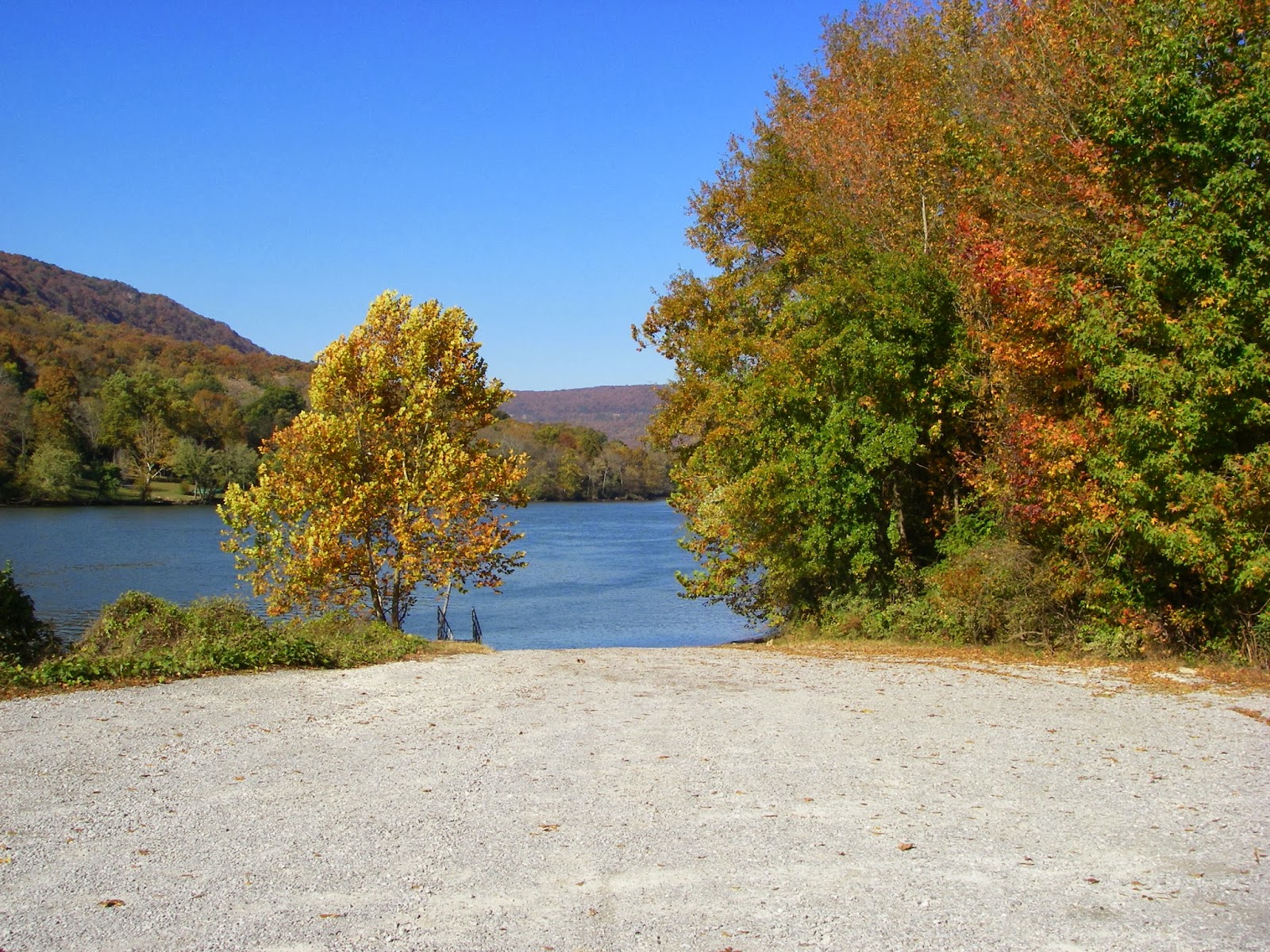
| Even the boat launch looks promising, especially in Fall when the leaves are changing. If I'm going on a river trip, this is the type of thing I like to see when I'm getting ready to launch. |
Mike chose to launch at a boat ramp off Suck Creek Road, just inside the mouth of the Gorge along the foot of Signal Mountain, with the intention to paddle down to another boat ramp at the foot of Raccoon Mountain, my usual mountain biking location (nearly 1000 feet above the river). The paddle is now about 9 miles of flat water, although prior to the construction of Nickajack Dam downstream, there were several major rapids in the Gorge. The dam floods out the whitewater. Since I'm a whitewater paddler, I hope someday in the future to see the rapids uncovered, like when Nickajack Dam is undergoing maintenance. On such a large river, the dams were constructed to provide navigability for freight traffic on barges, and to provide electricity generation, so unfortunately I think we can assume that any significant dam maintenance will be held to a minimum.
 |
| A nice wide view of the Tennessee River Gorge. It's actually part of Nickajack Reservoir these days. Unfortunately there were numerous motor boats racing through the gorge, including a "cigar boat" that must have been running in excess of 80 miles per hour if not faster. That said, all of us on the trip were whitewater paddlers so we are not troubled by even very large wake. |
We were initially encouraged by a fairly significant current at the launch, but within a short distance the current became negligible and we even got pushed back upstream by a mild headwind if we stopped paddling. It was as if we really dropped into Nickajack Lake proper. An examination of the upstream releases from Chickamauga Dam indicates that the flow was a relatively low 19,000 cubic feet per second for our run. I suspect the current would have been much stronger had we been luckier about those releases.
 |
| Rock chimneys and cliffs on Signal Mountain. The mountain got it's name from it's use during the US Civil War by the federal army. |
 |
| The mouth of Suck Creek, a popular class V+ whitewater run that drops precipitously off Signal Mountain. No, I don't paddle that. Suck Creek got it's name from the days before the gorge was flooded out by Nickajack Dam, far downstream. There was once a huge rapid featuring a great whirlpool called "The Suck." I presume the rapid was once right below where we were floating on the surface of the lake when I took this photo. |
 |
| The bluffs and cliffs on Elder Mountain. |
 |
| Fall colors at the lower elevations. |
 |
| Fall colors below the residence of an heir to the Olan Mills fortune. As the saying goes, if you have a good view, then someone else does not. I'd rather not see a house in this section of the Gorge which was otherwise the most naturally preserved stretch. One of the peculiar things about living in the Chattanooga area is the presence of several "old money" families, unusual for such a modestly sized town. This seems to date back all the way to the Reconstruction era after the Civil War and continued through the post-Reconstruction times when Chattanooga was one of the few towns in the South to benefit from the wealth generated by the Industrial Revolution. |
The river bends left and right, walled in by the forested scree slopes and the rocky bluffs of the mountainous edges of the Cumberland Plateau. Most trees were still clothed in leaves, although we all agreed that the colors had been slightly more vivid the previous two days and had tamed to russets, browns, and burnt oranges. It was still beautiful, just not as bright. We had just missed the peak colors. That was unfortunate, but it's a beautiful place to be at any time of year. Above us rock chimneys and caprock looked down on us, with a perfectly clear, deep blue sky arching between the canyon walls. It's a place to build memories.
 |
| Spectacular cliffs across from the takeout on river left at the Raccoon mountain pumped storage facility. This picture is totally lame. The actual scene was stunning in the falling light of late afternoon. |
 |
| The inlet of the Tennessee Valley Authority's Raccoon Mountain Pumped Storage Facility. Water is drawn in here and pumped up through tunnels in the mountain to a lake on top when the price of electricity is low. When the price goes up, water is released from the facility back down through the mountain for power generation using turbines located inside the tunnel system, barely visible in this photo. There is an elevator that runs up through the mountain to the building visible up there on the bluffs, roughly a thousand feet above the river level. I mountain bike up there all the time and the view from an overlook platform up there is one of my favorite places. I plan to blog about that some other day. |
We were awed by the scenery, but eventually the lengthy flatwater paddle became trying. We reached the takeout tired, but rewarded. After some boat loading and banter at the takeout, we retired to Mojo Burrito in the St. Elmo neighborhood for some delicious food and beer. It was a good way to spend a Sunday. Thanks Lois for including me!


Comments
Post a Comment