In Search of the Epic, Unrideable, East Coast Hike-a-Bike
Chilhowee Mountain Trail System
Cherokee National Forest, Tennessee
June 16, 2013
I've ridden Chilhowee Mountain several times, but the only time I enjoyed a good day on the trail I drove to the top and started from a parking lot already "at elevation." I've also started at the bottom a couple of times and my right knee (and self-esteem) were damaged by the time I got to the top. To any self-respecting mountain biker, this is unacceptable. The right knee damage can be avoided by adjusting the bike fit properly, but the self esteem can only be satisfied by climbing the mountain without feeling like you are ready to die by the time you get to the top. I decided I had to test myself again.
Ibuprofen is the friend of adventure. I made certain I'd taken plenty. Then I parked the truck on Highway 64 where it would be less likely to be broken into, filled the CamelBak, made sure the bike was 100%, headed up Highway 30 to the trailhead, and thence up the mountain. Every time I've ridden the Clemmer Trail to the top of the mountain, it's gotten easier. This time, just when I thought I was going to die, I made it. After I was certain the trail had leveled off, I stopped to rest, drink some water out of the CamelBak, and then continued. One of the differences between being in shape and out of shape is recovery time. I was amazed at how quickly and how well I recovered and in no time was cruising along the relatively level trails on top of Chilhowee and thoroughly enjoying myself.
I visited the lake in the recreation area. Then I visited the kiosk with a detailed trail map posted to select some possible routes. I had not planned ahead, since my previous climbs of Chilhowee had left me in such a terrible state that by the time I got to the lake I just wanted to ride back down to my vehicle. This time I felt ready for some more mileage.
I used my iPhone to take a snapshot of the map and selected an easy route on top of the mountain that would give me a more advanced option for the descent. I thoroughly enjoyed the easy riding on the Azalea Trail and the Arbutus Trail, adding over two miles to the ride. Then when the option presented itself, the Clear Creek Trail, I decided to take it. I had recently heard about the Clear Creek Trail on the one of the internet discussion boards I frequent described as the "true East Coast epic Hike-a-bike." Even though that sounds terrible it's the kind of thing I have trouble resisting. I went for it.
The first couple of miles of the Clear Creek Trail are wonderful and consist of pretty easy riding, albeit on an increasingly narrow trail. This lulls the unsuspecting riders into a sense of security. I was travelling quickly, and making pretty gradual progress down the mountain. Then things started to get more technical. I had a minor crash riding over some rocky ground. Nothing too bad, only a little bit of blood. Then things started to get out of hand.
The trail ran steeply down the mountain. It was an old school mountain bike or hiking trail that was designed with not much thought given to erosion. As a consequence, it was heavily rutted out by water flow. It was also covered with very large gravel of a type that is particularly hazardous to mountain bikes. Eventually, much to my surprise, I ended up doing significant climbing up similarly eroded trail, having to stop at one point (much to my annoyance) due to simply not being able to keep the line and riding off into the trees. I jumped off the bike, cussed and got back on. I chose to walk much of the screaming downhill, although it was within my ability, just because I was by myself. I felt the risk was too great.
After this section of the trail, I hit the true hike-a-bike, things that I would not even consider riding even if I was in a good strong group (to call the ambulance). This consisted of super-chunky rock gardens and narrow path right next to steep mountain slopes. I remember laughing at it and actually having to carry my bike a few times. Even pushing the bike was impossible. I had found it, the elusive true East Coast Epic Hike-a-Bike.
Finally the trail leveled off, even as it began to disappear. I finally came upon a place where I could choose between two overgrown options. The straight option led by the shortest path to Highway 30, the right option promised over a mile back to the Clemmer Trailhead. Since I wasn't parked at the Clemmer Trailhead but on Highway 64, I elected to take the straight option. It quickly became severely overgrown and passed through a tangle of blackberry and greenbriar. It was an outright thicket. I pushed on still further, walking the bike as necessary to push my way past branches and thickets. I forgot to mention the stream crossings. There were a couple.
Just when I began to doubt I was still on the trail, I finally reached Highway 30. Much to my surprise, I realized I was nowhere near Highway 64 where my pickup was parked. Oh, well, I thought, I was seeking adventure. Honestly riding on Highway 30 made me more nervous than anything on the trail due to the high speed at which the locals travel on it and the abundance of tourists unfamiliar with the road and possibly unfamiliar with mountains entirely. It's a very narrow, windy mountain highway and the approximately one mile or mile and a half back to my truck worried more than any obstacle I encountered on the trail.
Well it was an epic ride, and one of the better adventures I've enjoyed since I started mountain biking. I can't recommend it for general audiences but if you like adventure and you like to mountain bike, then the Clear Creek Trail might be for you. I forgot to start any of my devices recording the ride but feel quite confident it amounted to at least 13 miles of riding and I'm sure 1000 feet or more of climbing. It was a good ride. I got back just in time to avoid the afternoon thunderstorms.
Cherokee National Forest, Tennessee
June 16, 2013
I've ridden Chilhowee Mountain several times, but the only time I enjoyed a good day on the trail I drove to the top and started from a parking lot already "at elevation." I've also started at the bottom a couple of times and my right knee (and self-esteem) were damaged by the time I got to the top. To any self-respecting mountain biker, this is unacceptable. The right knee damage can be avoided by adjusting the bike fit properly, but the self esteem can only be satisfied by climbing the mountain without feeling like you are ready to die by the time you get to the top. I decided I had to test myself again.
Ibuprofen is the friend of adventure. I made certain I'd taken plenty. Then I parked the truck on Highway 64 where it would be less likely to be broken into, filled the CamelBak, made sure the bike was 100%, headed up Highway 30 to the trailhead, and thence up the mountain. Every time I've ridden the Clemmer Trail to the top of the mountain, it's gotten easier. This time, just when I thought I was going to die, I made it. After I was certain the trail had leveled off, I stopped to rest, drink some water out of the CamelBak, and then continued. One of the differences between being in shape and out of shape is recovery time. I was amazed at how quickly and how well I recovered and in no time was cruising along the relatively level trails on top of Chilhowee and thoroughly enjoying myself.
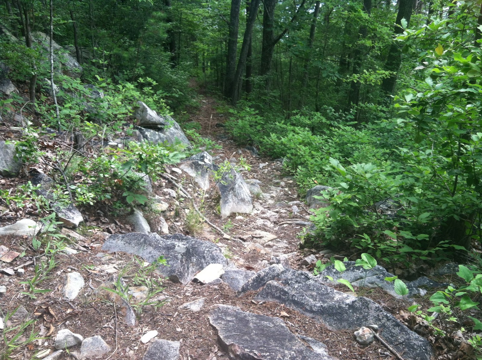
 |
| A sample of the narrow views available from the Clemmer Trail and Clear Creek Trail. Sorry, I didn't bring my camera again so this was taken with an iPhone 4. |
I visited the lake in the recreation area. Then I visited the kiosk with a detailed trail map posted to select some possible routes. I had not planned ahead, since my previous climbs of Chilhowee had left me in such a terrible state that by the time I got to the lake I just wanted to ride back down to my vehicle. This time I felt ready for some more mileage.
I used my iPhone to take a snapshot of the map and selected an easy route on top of the mountain that would give me a more advanced option for the descent. I thoroughly enjoyed the easy riding on the Azalea Trail and the Arbutus Trail, adding over two miles to the ride. Then when the option presented itself, the Clear Creek Trail, I decided to take it. I had recently heard about the Clear Creek Trail on the one of the internet discussion boards I frequent described as the "true East Coast epic Hike-a-bike." Even though that sounds terrible it's the kind of thing I have trouble resisting. I went for it.
The first couple of miles of the Clear Creek Trail are wonderful and consist of pretty easy riding, albeit on an increasingly narrow trail. This lulls the unsuspecting riders into a sense of security. I was travelling quickly, and making pretty gradual progress down the mountain. Then things started to get more technical. I had a minor crash riding over some rocky ground. Nothing too bad, only a little bit of blood. Then things started to get out of hand.
The trail ran steeply down the mountain. It was an old school mountain bike or hiking trail that was designed with not much thought given to erosion. As a consequence, it was heavily rutted out by water flow. It was also covered with very large gravel of a type that is particularly hazardous to mountain bikes. Eventually, much to my surprise, I ended up doing significant climbing up similarly eroded trail, having to stop at one point (much to my annoyance) due to simply not being able to keep the line and riding off into the trees. I jumped off the bike, cussed and got back on. I chose to walk much of the screaming downhill, although it was within my ability, just because I was by myself. I felt the risk was too great.
 |
| I could have ridden this but decided it was too risky. Also, it's a lot steeper than it looks in the photo - isn't that always the case? |
 |
| An opposing slope of Chilhowee Mountain. This view came somewhere just uphill of the really rugged section of the Clear Creek Trail. |
After this section of the trail, I hit the true hike-a-bike, things that I would not even consider riding even if I was in a good strong group (to call the ambulance). This consisted of super-chunky rock gardens and narrow path right next to steep mountain slopes. I remember laughing at it and actually having to carry my bike a few times. Even pushing the bike was impossible. I had found it, the elusive true East Coast Epic Hike-a-Bike.
 |
| The true unrideable, at least for us mortals. |
Finally the trail leveled off, even as it began to disappear. I finally came upon a place where I could choose between two overgrown options. The straight option led by the shortest path to Highway 30, the right option promised over a mile back to the Clemmer Trailhead. Since I wasn't parked at the Clemmer Trailhead but on Highway 64, I elected to take the straight option. It quickly became severely overgrown and passed through a tangle of blackberry and greenbriar. It was an outright thicket. I pushed on still further, walking the bike as necessary to push my way past branches and thickets. I forgot to mention the stream crossings. There were a couple.
 |
| Stream crossing. This was possibly rideable but I had no interest in doing that so more hiking ensued. |
Just when I began to doubt I was still on the trail, I finally reached Highway 30. Much to my surprise, I realized I was nowhere near Highway 64 where my pickup was parked. Oh, well, I thought, I was seeking adventure. Honestly riding on Highway 30 made me more nervous than anything on the trail due to the high speed at which the locals travel on it and the abundance of tourists unfamiliar with the road and possibly unfamiliar with mountains entirely. It's a very narrow, windy mountain highway and the approximately one mile or mile and a half back to my truck worried more than any obstacle I encountered on the trail.
Well it was an epic ride, and one of the better adventures I've enjoyed since I started mountain biking. I can't recommend it for general audiences but if you like adventure and you like to mountain bike, then the Clear Creek Trail might be for you. I forgot to start any of my devices recording the ride but feel quite confident it amounted to at least 13 miles of riding and I'm sure 1000 feet or more of climbing. It was a good ride. I got back just in time to avoid the afternoon thunderstorms.


Comments
Post a Comment