(Sorry about the poor photos, I forgot to charge the battery for my camera and had to rely on my iPhone 4 again.)
I've had a couple of the more obscure hikes in the nearby Ocoee Ranger District of Cherokee National Forest in my plans for quite some time, but for some reason have never gotten around to actually following through. Probably the biggest factor was the remoteness of both options. One is the Big Lost Creek Trail, located roughly in the vast chaos of mountains that lay roughly between the gorges of the Ocoee and Hiwassee Rivers. Lost Creek is a tributary of the Hiwassee, and whitewater paddlers are familiar with it as the creek that flows into the river just above Devil's Shoals. Everyone stops there to practice rolling their kayaks and canoes in the warm waters of the creek (in the summer it's warmer than the river). The upper branches of Lost Creek, including Big Lost Creek, are some miles upstream and have to be reached by a lengthy twisting route that ascends over mountains and past abandoned cemeteries and very remote homesteads and cabins for 7 miles from Highway 30. We finally found the point where the forest service road crosses the creek (along with the Benton McKaye trail).
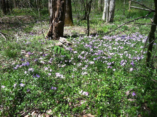 |
| Wildflowers carpeted the forest floor around the Big Lost Creek Campground in Cherokee National Forest. |
We had a lot of difficulty locating the trail and wandered around on both sides of the stream, upstream and downstream, including hiking up a very short section of the Benton McKaye Trail, and finally figured out that the trailhead is a.) not marked, and b.) requires a stream crossing on a side tributary that was flowing with a little too much water. Too make matters worse, there was a huge fallen tree right where the trail normally crosses, which was the most favorable spot for crossing. I could have made the jump or squirreled across the fallen tree but it didn't seem viable for Lois so we decided to just take some pictures of the wildflowers and go on to the next option, the Coker Creek Falls Trail, on the other side of the Hiwassee.
We studied my slightly outdated National Geographic trail map of the Hiwassee-Ocoee region and Lois selected the best route - Towee Pike Road. I offered that "Pike" and "Road" are redundant and Lois agreed but that's the name on the map. I have noticed Google maps show it as simply Towee Pike. This option is also located in a vast area of mountainous terrain and forest located in between the Hiwassee River and the Tellico River. It is a rugged and sparsely populated area, frequented mostly by hunters and some of your more intrepid camping and backpacking types - and scary Deliverance type characters sometimes. After a couple of questionable turns and ascending over some fairly tall mountains, twisting through high hollows and through some braided swampy streams, we finally crested at some very remote gap and found a sign for the Coker Creek Falls trail. A warning: there is at least one false turn you could take because the trail is linear and has two parking areas and trailheads. If you don't want to do a 6 mile round trip hike then you need the one with the falls.
We pulled up and parked in front of a very healthy looking stream, flowing swiftly with clear water in a steep ravine. The trail was wide and well-beaten. Shortly we came upon the first set of falls. As a paddler I thought the first drop looked quite runnable and then I felt my throat tighten as I looked downstream over a major horizon line to see mist rising up.
 |
| One of the upper sets of falls on Coker Creek. |
We stopped to take some photos and moved on downstream along the trail and quickly saw just how steeply the creek dropped away. It was a series of waterfalls and cascades stretching downstream as far as the eye could see. We took more photos and continued further downstream only to see the pattern repeating. I have seen very small creeks that drop down mountains at a very steep rate but I've never seen a stream this large that drops this quickly. Since I'm into whitewater, I was aware that creeks like this exist, and are paddled, but this was my first experience seeing it in person. This creek is steep as hell. Paddling it at a good level would make the Upper Tellico look like child's play. I do not think I will ever paddle it but I would image it's an intense experience.
 |
| One of the lesser drops of Coker Creek. |
 |
| Still more gradient on Coker Creek. |
 |
| Did I mention this creek is steep! This is a lengthy class V+ rapid. |
At some point along the trail I noticed some squirming movement off to the side of the trail and at first thought it was a lizard, but within a couple of seconds I had picked out a Copperhead snake, well camouflaged in the brush. The Copperhead is a poisonous pit viper and in the past, when I've seen one, I've frequently seen others. As a consequence, we spent the rest of the day watching carefully where we stepped.
 |
| A poisonous Copperhead snake, a common pit viper. |
We eventually came upon an area where the under-story had burned out. The trail had moved some distance away from the creek and it was getting late, so we decided to head back to the truck to go for some food. It was a good day but I was worn out from the exploration and driving many, many miles on very steep, gravel and bedrock forest service road. We stopped in at the Whitewater Grill on Highway 64 near Ocoee and had grilled fish and shepherd's pie. A good end to the day.
 |
| I like this photo despite the washed out look resulting from taking a photo into the sun. We went through several lovely high valleys and hollows like this one on our foray into some of the more remote parts of East Tennessee. |


Comments
Post a Comment