Arnold Air Force Base
Tullahoma, Tennessee
12/15/2012
My friend Stacy arranged to meet some of her friends Dave and
Paul at the mountain bike trail system at the Air Force’s Arnold Engineering
Development Center (AEDC) near Tullahoma, Tennessee to explore a place that had
been on her list for a while. She also was running an errand to exchange some
cash for a used dry suit (for paddling whitewater) for a friend, which made the trip feel a little like a
smuggling run. Nonetheless, I quickly decided that I was up for the adventure because AEDC had
also been on my list since I first started riding in 2009 and there would be a
guide familiar with the trails along to show the way. It was too good an opportunity to pass up. Things started
off inauspiciously as it was raining in Lookout Valley when we met up to
carpool from the Chattanooga area but after we got rolling, we drove out of the
rain in short order and although overcast it was quite warm for mid-December.
I had messaged ahead for my friend Kenny Warwick to meet us
at AEDC at the appointed time so the group grew to 5, the largest group I have
ridden with so far. Everybody was running significantly early although Kenny
had forgotten his helmet and trail map at home. He decided to go ahead and ride
anyway. The parking lot for the trail is not well marked at all. Fortunately
Stacy had good directions in an email from one of her friends so we found it on
the first try although we felt no certainty until we got quite close.
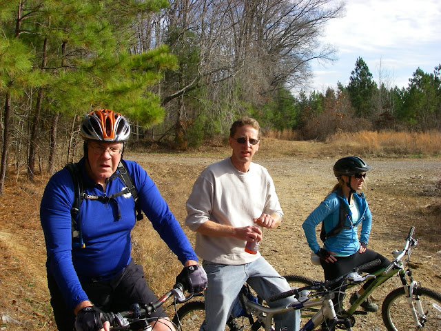 |
| Why is everyone breathing hard? |
 |
| Guide Paul on the right. |
The AEDC trail system was built over an abandoned gunnery
range. The Air Force issues warnings not to touch any ordnance you might
come across. While worrisome, I assumed crashing my bike was probably a much
greater threat so I decided to worry about that instead. The area is mostly
forested, with a few power line cuts and some fire road double track threading
through it. The trails are mostly single track but wander onto the double track from time to time. The terrain is fairly level with only
short climbs. The trail builders took advantage of the forest to make up for
the lack of topographical relief and there are frequent sections of trail that
setup a relentless slalom between and around the trees, with many tight turns
threatening to throw you into an oak or pine. Speaking of pines, the trail
system features long stretches of quiet, needle carpeted trail, one of my
favorite things. I love the muffled sounds and the open forest understory of a stand of pines. Of course, these pines are almost certainly artificially
planted due to the trail system being on the grounds of an Air Force base. This reminded me quite a bit of the Saul Raisin Woods trail system just outside Dalton, Georgia, which is built on a remediated landfill.
Remediation is great, but you can always tell the difference from natural
forest and topography.
 |
| Sunny double track at a point where the single track crosses over. At times the trail signs direct you down some of this. |
I still do not entirely comprehend the trail system there
but it’s pretty unique in that most of the trail seems to actually be a single
trail, numbered in order with sections of increasing difficulty, so that the
farther you ride, the more difficult the trail is. It’s as if the trail
designers were actually video game designers. I kind of expected to have to
beat a “boss” villain in the last segment before I could get back to my car.
 |
| Trail numbers mark segments rather than separate trails. If ridden in order the difficulty increases with the number. |
Eventually Dave and Kenny tired out and took an option to
return to the parking lot where the trail system crosses over the road. By that
time I would say we had ridden at least 5 or 6 miles and it was still at least
that much further by following the trail to get back, so they were cutting off
quite a bit of trail that would have had to be ridden. It’s nice to have these
options to turn back if you find yourself struggling.
Somewhere around trail segment 15 or 16 you go through a
quite intense slalom between some pines and end up riding along Woods
Reservoir, with the Cumberland Plateau escarpment in the background. The
afternoon sun on the lake made for some great views. The reservoir has
developed some nice gravel beaches along the lake shore. This section was nice
for the technical riding and for the scenery but as is often the case when you
are riding close to water, there were too many roots. Soon I was longing for a
full suspension bike. I was hoping to have one by now but it’s always a
question of money and priorities and I haven’t found the time right yet.
Someday soon hopefullyJ
 |
| The escarpment of the Cumberland Plateau on the far side of Woods Reservoir. |
 |
| My guess is this was once a blind for hunting waterfowl? |
 |
| Gravel beach on Woods Reservoir in the afternoon sun. |
Finally we crossed back over the road and got into the high
numbered trail segments (high being over 20) and were approaching the car. My
right knee was starting to complain and the trail crossed over a series of
ravines, or perhaps it was the same ravine over and over again. Either way this
resulted in some short but steep climbs, which would not have signified much to
me if they had not been so thoroughly covered with roots. Classic East Coast
mountain biking – too many roots. Soon I was daydreaming about Colorado Front
Range trail again. We finally made it back to the parking lot. As we were
approaching the cars, I heard Stacy scream behind me. She had run over a
hapless chipmunk that had run in front of her tires. I’m not sure what to make
of that but it was an unpleasant end to an otherwise pleasant ride. We shook
hands, loaded up and headed back to Chattanooga for some Mexican food. It was a
great day on a new trail. I’d rate the AEDC trail system as entertaining but
only medium compared to much of the trail near Chattanooga. Still, I’d go back.
[Use caution if you go because hunting is allowed in the
forest and it is closed to non-hunting users at certain times of year.]


Comments
Post a Comment