Smokies Hiking - Mount Cammerer Hike
June 23, 2012
I headed back up to the Smokies again to hike the Appalachian Trial up to the lookout on Mount Cammerer. I took an unusual route from a lightly used trailhead at Davenport Gap on Mt. Sterling Road right on the North Carolina-Tennessee border above the Big Creek area. There are two advantages to starting from this point. First the road ascends a good bit before you get to the trailhead, saving some climbing. The second advantage is that access from Interstate 40 is less than 10 minutes. That's hard to beat. The disadvantages are limited parking (it wasn't a problem for me), poor security due to the remoteness of the trailhead, and I think it's a little longer distance to the summit (5.8 miles - 11.6 round trip). As usual with the Appalachian trail there were relatively few switchbacks making for a very steep hike up to the summit. I left way too late in the day but pushed hard to the top and got away with it - no bad weather in the afternoon and I was rewarded with cool breezes and spectacular views.
Video of a walk around the Mt. Cammerer lookout.
I really enjoyed this hike quite a bit but I definitely recommend good fitness and an early start. I didn't start until 12:45 pm and pushed too hard trying to get to the top in time to make it back to my car by dark and hopefully beat any late afternoon thunderstorms. As it happened I got lucky and didn't get rained on. I also didn't take enough fluids and wished I had taken my 70 oz. CamelBak Rogue. Live and learn. Great hike anyway!
I headed back up to the Smokies again to hike the Appalachian Trial up to the lookout on Mount Cammerer. I took an unusual route from a lightly used trailhead at Davenport Gap on Mt. Sterling Road right on the North Carolina-Tennessee border above the Big Creek area. There are two advantages to starting from this point. First the road ascends a good bit before you get to the trailhead, saving some climbing. The second advantage is that access from Interstate 40 is less than 10 minutes. That's hard to beat. The disadvantages are limited parking (it wasn't a problem for me), poor security due to the remoteness of the trailhead, and I think it's a little longer distance to the summit (5.8 miles - 11.6 round trip). As usual with the Appalachian trail there were relatively few switchbacks making for a very steep hike up to the summit. I left way too late in the day but pushed hard to the top and got away with it - no bad weather in the afternoon and I was rewarded with cool breezes and spectacular views.
 |
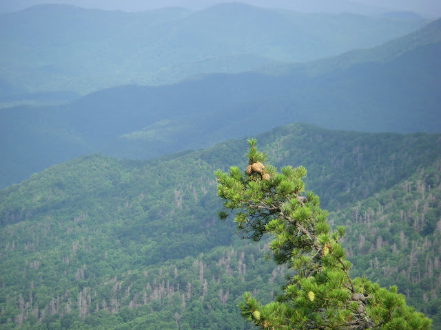
| Awesome pine cones hanging out over a giant gulf. It's better in person. This was from the AT as it nears the crest of Mt. Cammerer. I climbed up on a small rock outcropping to get the best view. |
 |
| The approach trail on top of the mountain. It reminds me of some of the scrub oak forest you see out west. |
 |
| The approach to the lookout, which is located out on a rocky promontory. |
 |
| Taken from a rock outcropping on the promontory. This was an amazing wild view but I got a little agoraphobic taking photos. Losing your balance would not be a good idea here. |
 |
| The Great Smoky Mountains |
 |
| The view from the catwalk around the outside of the lookout structure. |
 |
| I-40 approaching the Smokies. This is roughly looking towards Knoxville, Tennessee. |
 |
| Big country. Notice all the dead trees. I'm not sure if this is the work of the woody adelgid? |
 |
| More dead trees on the slopes below Mt. Cammerer. |
 |
| Another view from the rail. |
I really enjoyed this hike quite a bit but I definitely recommend good fitness and an early start. I didn't start until 12:45 pm and pushed too hard trying to get to the top in time to make it back to my car by dark and hopefully beat any late afternoon thunderstorms. As it happened I got lucky and didn't get rained on. I also didn't take enough fluids and wished I had taken my 70 oz. CamelBak Rogue. Live and learn. Great hike anyway!


Comments
Post a Comment